product-img

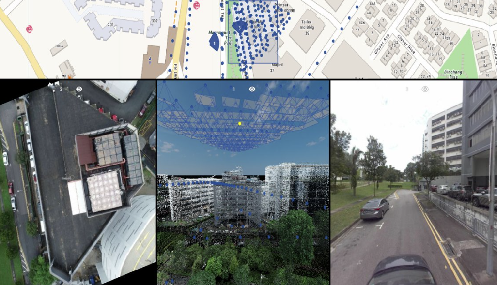
Revolutionize Your 3D Data Management and Visualization

Transform complex spatial data into actionable insights with our enterprise-grade platform and expert consultancy services. From advanced Lidar scanning to comprehensive data analysis, our end-to-end solutions empower you to capture, manage, analyze, and share 3D geospatial data with unprecedented efficiency. Experience the future of spatial data management with technology that scales with your needs and experts who understand your challenges.
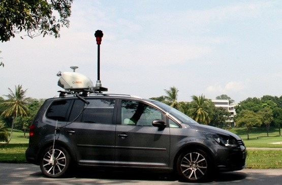
Advanced 3D Lidar Scanning & Consultancy

Our comprehensive 3D Lidar scanning solutions combine cutting-edge technology with expert consultancy to deliver precise, actionable spatial data. We offer:

  • Professional Data Acquisition - High-precision mobile and terrestrial Lidar scanning, with multi-sensor integration capabilities and custom solutions for complex environments.
  • Advanced Data Processing - Comprehensive point cloud processing, automated feature extraction, and rigorous quality control protocols.
  • Expert Consultancy - Personalized workflow development, technical training, and project-specific methodology planning.
3D Lidar Scanning Services
Software Platform Features

Enterprise-Grade 3D Data Management Platform

Our powerful platform transforms how organizations manage and utilize 3D spatial data:

  • Advanced Visualization - Real-time 3D visualization of massive point clouds with high-performance rendering and intuitive navigation.
  • Comprehensive Analysis Tools - Automated measurements, change detection, and customizable analytics dashboards.
  • Enterprise Collaboration - Secure data sharing, real-time team collaboration, and robust project management capabilities.

Comprehensive 3D Data Solutions

Enterprise Data Management

Scale your spatial data infrastructure with our enterprise platform. We provide secure data hosting, seamless system integration, and performance optimization to ensure your data management needs are met efficiently and securely.

Professional Scanning Services

Leverage our expertise in mobile and terrestrial Lidar scanning for precise data collection. Our multi-sensor approach and specialized equipment ensure comprehensive coverage for any environment or project requirement.

Technical Consulting

Optimize your workflows with our expert consultation services. We provide comprehensive training, implementation support, and best practice guidance to maximize the value of your 3D data infrastructure.

Expert Data Processing

Transform raw data into valuable insights with our advanced processing services. From point cloud optimization to feature extraction, we ensure your data meets the highest quality standards.

Project Management

Ensure project success with our comprehensive project management services. We coordinate all aspects of your 3D data initiatives, from planning to final delivery, with clear communication and milestone tracking.

Customization Services

Adapt our solutions to your specific needs with custom development services. We create tailored workflows, specialized features, and integrated solutions that align perfectly with your organization's requirements.

Transform Your 3D Data Management Today

Ready to revolutionize how your organization handles spatial data?

Get Started

FAQ

What makes CMS Solutions different from other 3D data management platforms?

Our solution provides an integrated ecosystem combining powerful software capabilities with comprehensive professional services and extensive industry expertise.

How does your platform handle large datasets?

Our system is built on advanced technology capable of handling massive point cloud datasets with efficient streaming and visualization capabilities, ensuring smooth performance even with complex data.

What security measures are in place for data protection?

Our platform implements enterprise-level security protocols including role-based access control, secure data transmission, and comprehensive audit trails.

What types of projects are best suited for your services?

Our solutions are ideal for infrastructure projects, urban planning, construction monitoring, asset management, and any application requiring precise 3D spatial data management and analysis.

What support and training do you provide?

We offer comprehensive support including implementation assistance, technical training, workflow optimization, and ongoing technical support to ensure your team maximizes the value of our solutions.

Can the software be customized for specific industry needs?

Yes, our platform can be customized to meet specific industry requirements, workflows, and integration needs while maintaining robust core functionality.

Contact Us